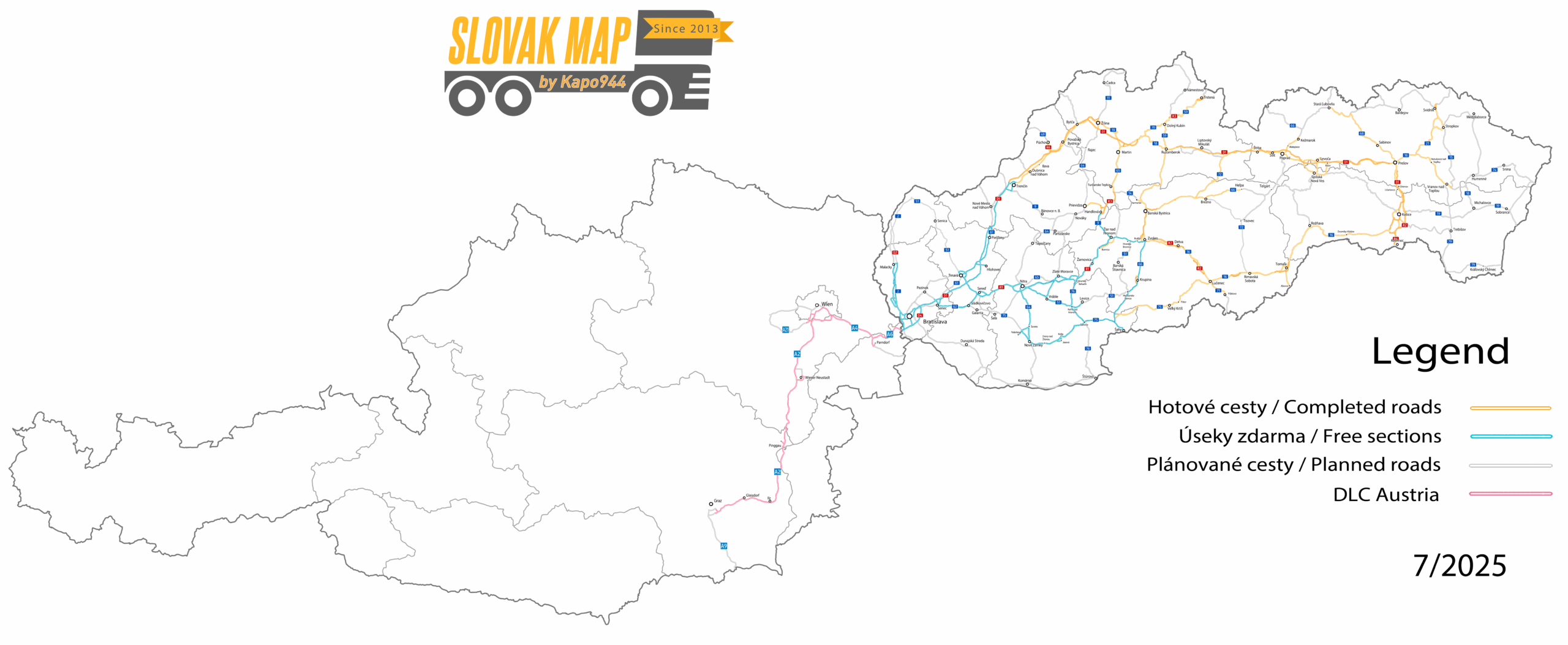
Current Map Development Status
The Slovak Map for ETS2 covers most of Slovakia in a 1:5 scale. On this page, you will find an up-to-date overview of completed areas, the latest additions, and upcoming planned sections. The map is constantly expanding and older parts are being modernized.
Stav podľa krajov k 12/2025
📍 Bratislava Region
- coverage: approx. 50%
- capitol city and surroundings (D1, D2, D4 highways)
- planned modernization in 2026
- Pezinok and extension towards Kúty are planned for the future
- Some bugs have been fixed
📍 Trnava Region
- coverage: approx. 40%
- new traffic signs were added in version 6.6.6
📍 Nitra Region
- coverage: approx. 45%
- the city of Nitra is scheduled for reconstruction
- the village of Tvrdošovce is closed due to planned development of the town Šaľa (6.6.9)
📍 Trenčín Region
- coverage: approx. 25%
- the city of Trenčín and its surroundings added (6.6.9)
- new signs and AI traffic behavior improvements
- planned expansion toward Bánovce nad Bebravou and Nováky
📍 Žilina Region
- coverage: approx. 75%
- added city of Liptovský Mikuláš (6.6.8)
- city of Žilina was modernized
- the whole region is gradually being updated, mainly Martin and Dolný Kubín
📍 Banská Bystrica Region
- coverage: approx. 50%
- the Lučenec area partially modernized, including the road to Rimavská Sobota
- Brezno freshly rebuilt according to new requirements (6.6.9)
- the city of Brezno- Mýto pod Ďumbierom and a road III/2378 was modernized (6.7.0)
📍 Prešov Region
- coverage: approx. 65%
- city of Kežmarok added (6.6.6)
- Klčov–Branisko completely rebuilt from scratch (6.6.9)
- ongoing modernization is planned for the entire route up to Prešov, including the city itself
- the village of Nemešany, Klčov, Spiš. Hrhov completely reguilt from scratch (6.7.0)
📍 Košice Region
- coverage: approx. 25%
- currently includes only the basic road framework
Map
Current road network as of 7/2025